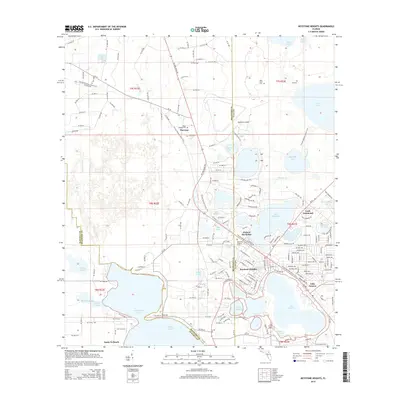
2015 Map of Keystone Heights
USGS Topo · Published 2015About this map
Keystone Heights serves as the central hub of this region, situated among a dense concentration of lakes at the intersection of State Road 21 and State Road 100. The landscape is defined by its water bodies, ranging from the expansive Santa Fe Lake and Lake Brooklyn to smaller features like Bolt Lake and Indian Lake. To the north, the Keystone Airpark and the settlement of Theressa mark the transition toward the Bradford County line, while the Florida National Scenic Trail winds through the western and central portions of the sheet, connecting these communities to the natural terrain. Local heritage is preserved in several burial grounds, including Keystone Heights Cem, Lee Cem, and the Hope Baptist Cem. Along the southern shores, Santa Fe Beach and Lake Geneva illustrate the historical draw of these waterfront locations for recreation and settlement.
Find a feature on this map
59 named features on this map. Tap any name to fly to it.
Don’t see what you’re looking for? This feature index may not catch every label — zoom into the map to look around manually.
Map Details
Editions of this 2015 Keystone Heights Map
This is the sole edition of this map. No revisions or reprints were ever made.
Other maps of this area

1915 · Interlachen
USGS Topo · 1:48,000

1916 · Interlachen
USGS Topo · 1:62,500

1938 · Hawthorn
USGS Topo · 1:48,000

1941 · Starke
USGS Topo · 1:62,500

1942 · Ates Creek
USGS Topo · 1:62,500

1943 · Hawthorn
USGS Topo · 1:62,500

1944 · Interlachen
USGS Topo · 1:62,500

1948 · Starke
USGS Topo · 1:50,000

1949 · Sampson
USGS Topo · 1:24,000

1949 · Gold Head Branch
USGS Topo · 1:24,000