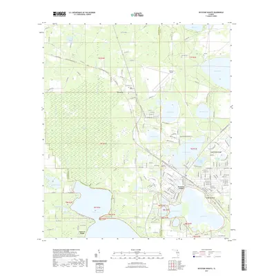
2021 Map of Keystone Heights
USGS Topo · Published 2021About this map
Keystone Heights sits at the center of a lake-dense landscape along the border of Bradford and Clay counties. This modern survey illustrates the proximity of residential development to significant water bodies like Lake Geneva and Lake Brooklyn, which are linked by the Santa Fe Canal to the expansive Santa Fe Lake in the southwest. To the northwest, the massive Santa Fe Swamp dominates the terrain, providing a sharp contrast to the established neighborhoods and the nearby Keystone Airpark.
Find a feature on this map
177 named features on this map. Tap any name to fly to it.
Don’t see what you’re looking for? This feature index may not catch every label — zoom into the map to look around manually.
Map Details
Editions of this 2021 Keystone Heights Map
This is the sole edition of this map. No revisions or reprints were ever made.
Other maps of this area

1915 · Interlachen
USGS Topo · 1:48,000

1916 · Interlachen
USGS Topo · 1:62,500

1938 · Hawthorn
USGS Topo · 1:48,000

1941 · Starke
USGS Topo · 1:62,500

1942 · Ates Creek
USGS Topo · 1:62,500

1943 · Hawthorn
USGS Topo · 1:62,500

1944 · Interlachen
USGS Topo · 1:62,500

1948 · Starke
USGS Topo · 1:50,000

1949 · Sampson
USGS Topo · 1:24,000

1949 · Gold Head Branch
USGS Topo · 1:24,000