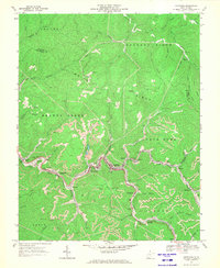
1967 Map of Keystone
USGS Topo · Published 1971About this map
Elkhorn Creek serves as the industrial and social spine of this McDowell County landscape, where the Norfolk and Western railway threads together a dense chain of coal-era settlements. In 1967, the valley floors are dominated by a continuous ribbon of community life and heavy industry, linking Keystone, Northfork, and Vivian to smaller enclaves like Landgraff and Eckman. The geography reflects the intense extraction of the era, with numerous Strip Mine operations and Mine Dump sites carved into the steep ridges of Shawnee Mtn and Indian Ridge.
Find a feature on this map
63 named features on this map. Tap any name to fly to it.
Don’t see what you’re looking for? This feature index may not catch every label — zoom into the map to look around manually.
Map Details
Editions of this 1967 Keystone Map
2 editions found
Other maps of this area

1887 · Pocahontas
USGS Topo · 1:125,000

1891 · Tazewell
USGS Topo · 1:125,000

1891 · Pocahontas
USGS Topo · 1:125,000

1891 · Oceana
USGS Topo · 1:125,000

1891 · Raleigh
USGS Topo · 1:125,000

1893 · Oceana
USGS Topo · 1:125,000

1894 · Pocahontas
USGS Topo · 1:125,000

1895 · Tazewell
USGS Topo · 1:125,000

1895 · Pocahontas
USGS Topo · 1:125,000

1897 · Tazewell
USGS Topo · 1:125,000