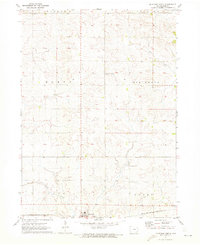
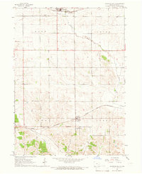
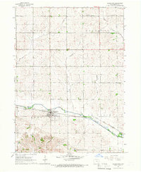
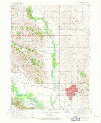
1971 Map of Keystone North
USGS Topo · Published 1973About this map
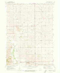
Keystone serves as the primary hub on the southern edge of this central Iowa landscape, positioned at the junction of agricultural fields and the Chicago Milwaukee St Paul and Pacific railroad. The terrain is defined by a series of drainage networks, with Mud Creek and Prairie Creek cutting through the township divisions of Homer, Big Grove, Kane, and Union. The map reveals a deeply rooted rural community, marked by the distribution of several family and local burial grounds including Big Grove Cem, La Rue Cem, and Bender Cem. The presence of a localized Townhall in the western reaches of the survey area suggests a time when local township governance and community gatherings remained central to the region's social structure before further modern consolidation.
Find a feature on this map
15 named features on this map. Tap any name to fly to it.
Don’t see what you’re looking for? This feature index may not catch every label — zoom into the map to look around manually.
Map Details
Editions of this 1971 Keystone North Map
This is the sole edition of this map. No revisions or reprints were ever made.
Other maps of this area

1954 · Waterloo
USGS Topo · 1:250,000

1954 · Des Moines
USGS Topo · 1:250,000

1955 · Waterloo
USGS Topo · 1:250,000

1956 · Des Moines
USGS Topo · 1:250,000

1957 · Des Moines
USGS Topo · 1:250,000
1965 · Keystone South
USGS Topo · 1:24,000
1965 · Blairstown
USGS Topo · 1:24,000
1968 · Belle Plaine
USGS Topo · 1:24,000

1969 · Des Moines
USGS Topo · 1:250,000
1971 · Elberon
USGS Topo · 1:24,000