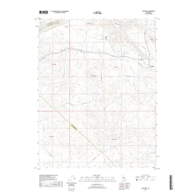
2018 Map of Keystone
USGS Topo · Published 2018About this map
Keystone and the rugged canyon of the Stanislaus River dominate this recent topographical survey of the Sierra Nevada foothills. The landscape is defined by its water management and distinct geology, featuring the prominent Table Mtn and the sprawling Red Hills. A critical piece of California's infrastructure, the Hetch-Hetchy Aqueduct, cuts across the terrain, carrying water from the mountains toward the coast. Local aviation is represented by the Kistler Ranch Airport, while several seasonal drainages like N Fork Dry Cr and Green Springs Run carve through the foothills. The map captures the meeting of three counties—Calaveras, Tuolumne, and Stanislaus—along the river and across the high ridges of Rushing Mtn, illustrating the complex topography where the Central Valley begins its ascent into the high sierra.
Find a feature on this map
32 named features on this map. Tap any name to fly to it.
Don’t see what you’re looking for? This feature index may not catch every label — zoom into the map to look around manually.
Map Details
Editions of this 2018 Keystone Map
This is the sole edition of this map. No revisions or reprints were ever made.
Other maps of this area

1893 · Sonora
USGS Topo · 1:125,000

1896 · Sonora
USGS Topo · 1:125,000

1897 · Sonora
USGS Topo · 1:125,000

1898 · Sonora
USGS Topo · 1:125,000

1915 · Paulsell
USGS Topo · 1:31,680

1915 · La Grange
USGS Topo · 1:24,000

1916 · Cooperstown
USGS Topo · 1:31,680

1916 · Copperopolis
USGS Topo · 1:62,500

1919 · La Grange
USGS Topo · 1:31,680

1942 · Copperopolis
USGS Topo · 1:62,500