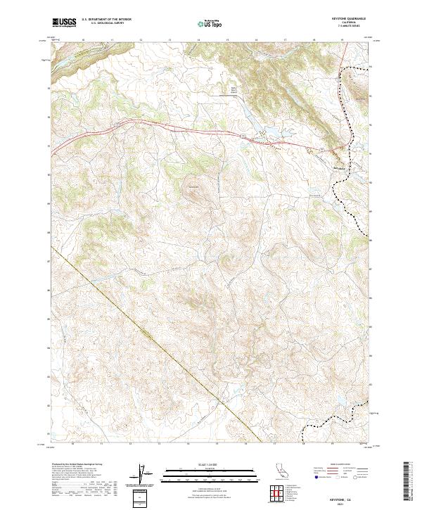
2021 Map of Keystone
USGS Topo · Published 2021About this map
Keystone sits at the junction of La Grande Rd and Green Springs Rd, serving as a central point in this transition from the Central Valley foothills toward the Sierra Nevada. The landscape is defined by its water management and aviation history, notably featuring the Kistler Ranch Airport and the massive subterranean engineering of the Hetch Hetchy Aqueduct, which cuts diagonally across the southwestern corner of the quadrangle. In the north, the Stanislaus River marks the boundary between Calaveras and Tuolumne counties, while the eastern edge is dominated by the Red Hills and Rushing Mtn. This area reflects a classic California ranching and utility corridor, where long-established routes like Tulloch Rd and Rock River Rd weave between seasonal drainages such as Owl Cr and Mountain Pass Cr.
Find a feature on this map
30 named features on this map. Tap any name to fly to it.
Don’t see what you’re looking for? This feature index may not catch every label — zoom into the map to look around manually.
Map Details
Editions of this 2021 Keystone Map
This is the sole edition of this map. No revisions or reprints were ever made.
Other maps of this area

1893 · Sonora
USGS Topo · 1:125,000

1896 · Sonora
USGS Topo · 1:125,000

1897 · Sonora
USGS Topo · 1:125,000

1898 · Sonora
USGS Topo · 1:125,000

1915 · Paulsell
USGS Topo · 1:31,680

1915 · La Grange
USGS Topo · 1:24,000

1916 · Cooperstown
USGS Topo · 1:31,680

1916 · Copperopolis
USGS Topo · 1:62,500

1919 · La Grange
USGS Topo · 1:31,680

1942 · Copperopolis
USGS Topo · 1:62,500