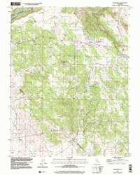
2000 Map of Keystone
USGS Topo · Published 2002About this map
Table Mountain and the Stanislaus River dominate the northern landscape of this Tuolumne County terrain, where the Tulloch Dam harnesses the river's flow near the boundary with Calaveras County. The map documents a rugged interior cross-cut by the Hetch Hetchy Aqueduct, a critical infrastructure link running east-to-west below Rushing Mtn.
Find a feature on this map
32 named features on this map. Tap any name to fly to it.
Don’t see what you’re looking for? This feature index may not catch every label — zoom into the map to look around manually.
Map Details
Editions of this 2000 Keystone Map
This is the sole edition of this map. No revisions or reprints were ever made.
Other maps of this area

1893 · Sonora
USGS Topo · 1:125,000

1896 · Sonora
USGS Topo · 1:125,000

1897 · Sonora
USGS Topo · 1:125,000

1898 · Sonora
USGS Topo · 1:125,000

1915 · Paulsell
USGS Topo · 1:31,680

1915 · La Grange
USGS Topo · 1:24,000

1916 · Cooperstown
USGS Topo · 1:31,680

1916 · Copperopolis
USGS Topo · 1:62,500

1919 · La Grange
USGS Topo · 1:31,680

1942 · Copperopolis
USGS Topo · 1:62,500