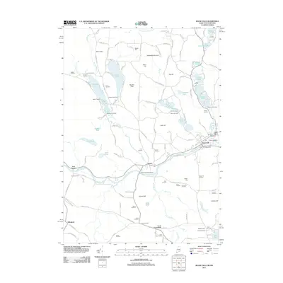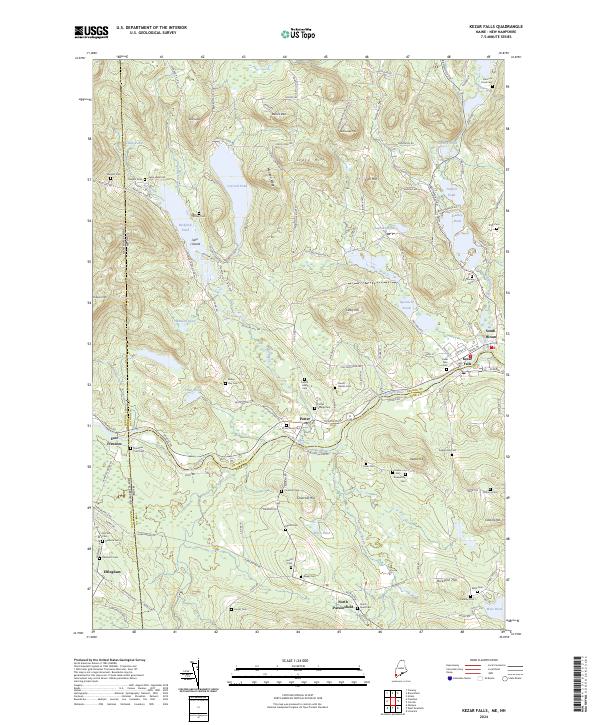
2024 Map of Kezar Falls
USGS Topo · Published 2024About this map
The Ossipee River carves a central path through this landscape, marking the border between Oxford Co and York Co as it flows past the historic village of Kezar Falls. This region is defined by its deep genealogical roots, evidenced by dozens of small family-named burial grounds like Ridley-Day Cem, French-Libby Cem, and Huntress-Pratt Cem scattered among the hills. To the north, the terrain rises toward Stacy Hill and the distinctive Devils Den, while the western edge crosses the state line into New Hampshire near East Freedom. A dense network of ponds, including Colcord Pond, Bickford Pond, and Stanley Pond, shaped the early settlement patterns and local transit routes like the Ossipee Trl and Bickford Pond Rd.
Find a feature on this map
123 named features on this map. Tap any name to fly to it.
Don’t see what you’re looking for? This feature index may not catch every label — zoom into the map to look around manually.
Map Details
Editions of this 2024 Kezar Falls Map
This is the sole edition of this map. No revisions or reprints were ever made.
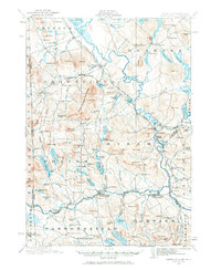
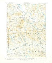
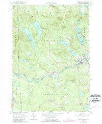
Historical Maps of Parsonsfield Through Time
8 maps found