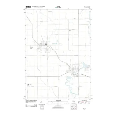
2010 Map of Kiel
USGS Topo · Published 2010About this map
New Holstein and Kiel anchor this landscape along the upper reaches of the Sheboygan River, capturing the region's agricultural and industrial character in the early 21st century. The map details the dense network of rural roads such as Honeymoon Hill RD and Seven Corners RD that connect outlying settlements like Steinthal and Meggers. Significant local landmarks include the New Holstein Municipal Airport and the Kiel Post Office, while the hydrology of the area is defined by Pine Creek and Jordan Creek. Researchers will find a high density of burial sites documenting the area's genealogy, including the New Holstein Public Cemetery, Bethel Methodist Cemetery, and Saint Anna Catholic Cemetery. Water management on the river is noted by the Rockville Dam and the Kiel 1855C149 Dam.
Find a feature on this map
60 named features on this map. Tap any name to fly to it.
Don’t see what you’re looking for? This feature index may not catch every label — zoom into the map to look around manually.
Map Details
Editions of this 2010 Kiel Map
This is the sole edition of this map. No revisions or reprints were ever made.
Other maps of this area

1954 · School Hill
USGS Topo · 1:24,000

1954 · Howards Grove
USGS Topo · 1:62,500

1954 · Chilton
USGS Topo · 1:62,500

1954 · Reedsville
USGS Topo · 1:62,500

1954 · Franklin
USGS Topo · 1:24,000

1954 · Kiel
USGS Topo · 1:62,500

1954 · Milwaukee
USGS Topo · 1:250,000

1954 · Manitowoc
USGS Topo · 1:250,000

1955 · Green Bay
USGS Topo · 1:250,000

1957 · Madison
USGS Topo · 1:250,000