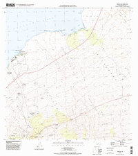
1996 Map of Kiholo
USGS Topo · Published 1998About this map
Lava Flow of 1859 and the Lava Flow of 1801 dominate this coastal landscape, illustrating the raw volcanic history of the Hawaii island shoreline. Settlements like Kiholo and Kaupulehu sit at the edges of these frozen stone rivers, where the land meets Kiholo Bay and the Pacific Ocean. This 1996 update, based on topography from the 1950s, highlights the difficult nature of the terrain, marked by scattered water sources like the Keanalele Waterhole and Waiakauhi.
Find a feature on this map
50 named features on this map. Tap any name to fly to it.
Don’t see what you’re looking for? This feature index may not catch every label — zoom into the map to look around manually.
Map Details
Editions of this 1996 Kiholo Map
2 editions found
Other maps of this area

1928 · Puako
USGS Topo · 1:62,500

1928 · Kailua
USGS Topo · 1:62,500

1954 · Hawaii North
USGS Topo · 1:250,000

1956 · Puu Hinai
USGS Topo · 1:24,000

1959 · Hawaii North
USGS Topo · 1:250,000

1959 · Kiholo
USGS Topo · 1:24,000

1959 · Hualalai
USGS Topo · 1:24,000
1959 · Anaehoomalu
USGS Topo · 1:24,000

1959 · Makalawena
USGS Topo · 1:24,000

1959 · Keahole Point
USGS Topo · 1:24,000