2022 Map of Killduff
USGS Topo · Published 2022About this map
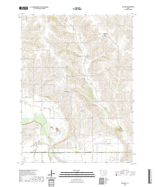
Killduff and Galesburg anchor this rural Jasper County landscape, showing the persistent grid of a modern Midwestern agricultural community. The terrain is defined by the winding course of the South Skunk River in the southwest, while drainage systems like Elk Cr and Little Elk Cr carve through the upland sections to the north and east. For local historians and genealogists, the map provides precise locations for several scattered burial sites that speak to the area's early settlement patterns, including Hewitt Cem, Saint Andrews Cem, and Dearinger Cem. The southern edge of the survey crosses the boundary from Jasper Co into Marion Co, near Kleins Cem. The infrastructure is a mix of established corridors like HWY f62 E and a dense network of numbered secondary roads, such as S 64th Ave E and S 120th Ave E, which facilitate the region's farming economy.
Find a feature on this map
39 named features on this map. Tap any name to fly to it.
Don’t see what you’re looking for? This feature index may not catch every label — zoom into the map to look around manually.
Map Details
Editions of this 2022 Killduff Map
This is the sole edition of this map. No revisions or reprints were ever made.
Historical Maps of Palo Alto Township Through Time
8 maps found

Featured Locations
- Lake Prairie Township, IA
- Summit Township, IA
- Richland Township, IA
- Elk Creek Township, IA
- Fairview Township, IA