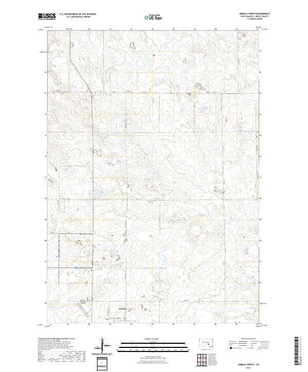
2021 Map of Kimball North
USGS Topo · Published 2021About this map
Kimball sits at the southern edge of this landscape, serving as a hub for the surrounding agricultural prairie of Brule County. The township boundaries, such as t104n r68w and t105n r67w, define a grid-iron network of section roads like 244th St and 365 Ave that crisscross the terrain. This rural topography is dotted with numerous small prairie potholes and wetlands, with Sobek Lake standing out as a primary water feature in the western half of the quadrangle. Transportation and infrastructure are concentrated near the settlement, where N Babcock St and N Truck St lead toward the northern residential and commercial outskirts. The presence of the Kimball Municipal Airport underscores the importance of regional connectivity for this remote farming community, while the vast stretches of open land to the north reflect the late twentieth-century continuity of South Dakota's interior plains.
Find a feature on this map
23 named features on this map. Tap any name to fly to it.
Don’t see what you’re looking for? This feature index may not catch every label — zoom into the map to look around manually.
Map Details
Editions of this 2021 Kimball North Map
This is the sole edition of this map. No revisions or reprints were ever made.
Other maps of this area

1941 · Pukwana
USGS Topo · 1:62,500

1941 · Kimball North
USGS Topo · 1:62,500

1951 · Pukwana
USGS Topo · 1:62,500

1951 · Kimball North
USGS Topo · 1:62,500

1955 · Mitchell
USGS Topo · 1:250,000

1959 · Mitchell
USGS Topo · 1:250,000

1979 · Bijou Hills NE
USGS Topo · 1:24,000

1979 · Platte Lake
USGS Topo · 1:24,000

1979 · Kimball South
USGS Topo · 1:24,000
1982 · Kimball North
USGS Topo · 1:25,000