
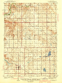
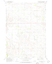
1941 Map of Kimball North
USGS Topo · Published 1941About this map
Kimball serves as the principal hub of this Brule County landscape just before the 1940s, situated along the Chicago Milwaukee St Paul and Pacific railroad. The map reveals an exceptionally dense network of rural schoolhouses, suggesting a highly organized and distributed agricultural community during this era. Named educational landmarks like Prairie Belle Sch, Plainview Sch, and Boeson Sch are scattered across the townships of Lyon, Plummer, and Pratt, serving as vital centers for the families farming these plains.
Find a feature on this map
32 named features on this map. Tap any name to fly to it.
Don’t see what you’re looking for? This feature index may not catch every label — zoom into the map to look around manually.
Map Details
Editions of this 1941 Kimball North Map
This is the sole edition of this map. No revisions or reprints were ever made.
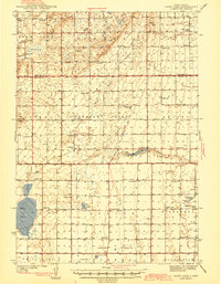
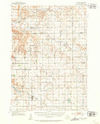
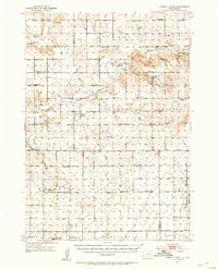
Other maps of this area
1941 · Pukwana
USGS Topo · 1:62,500
1942 · Crow Lake
USGS Topo · 1:62,500
1951 · Pukwana
USGS Topo · 1:62,500
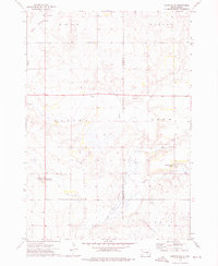
1951 · Kimball North
USGS Topo · 1:62,500

1953 · Huron
USGS Topo · 1:250,000

1954 · Huron
USGS Topo · 1:250,000

1955 · Mitchell
USGS Topo · 1:250,000

1959 · Mitchell
USGS Topo · 1:250,000
1973 · Big Bend Dam 4 SE
USGS Topo · 1:24,000
1973 · Gannvalley
USGS Topo · 1:24,000
Featured Places
- Kimball, Kimball Township
- Lyonville, Lyon Township
- Logan Township, SD
- Plainfield Township, SD
- Plummer Township, SD