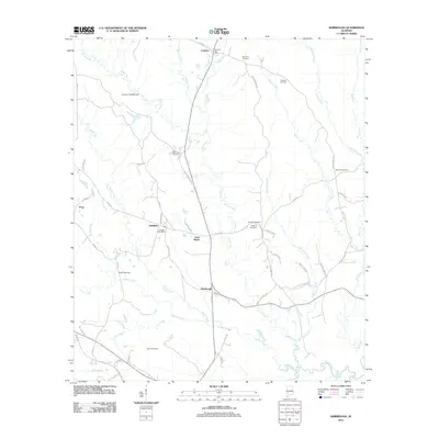
2011 Map of Kimbrough
USGS Topo · Published 2011About this map
Arlington and Lamison serve as focal points for this rural Wilcox County landscape, where the geography is defined by a dense network of creek systems and small family-named settlements. The map illustrates a community structure centered around local post offices and numerous burial grounds, such as Dunaway Cemetery and Saint Matthews Cemetery, which are vital for genealogical research in this part of Alabama. The hydrography is particularly intricate, featuring the James C Ratcliffe Dam and the winding paths of Turkey Creek, Goose Creek, and Moccasin Creek. The road network, including the specifically named Lily Baptist Church Rd and Zack Williams Rd, suggests a pattern of land ownership and local connectivity that has persisted through the early 21st century. Smaller locales like Anne Manie and Kimbrough further detail the distribution of residents across the varied terrain.
Find a feature on this map
66 named features on this map. Tap any name to fly to it.
Don’t see what you’re looking for? This feature index may not catch every label — zoom into the map to look around manually.
Map Details
Editions of this 2011 Kimbrough Map
This is the sole edition of this map. No revisions or reprints were ever made.
Other maps of this area

1953 · Montgomery
USGS Topo · 1:250,000

1953 · Andalusia
USGS Topo · 1:250,000

1956 · Montgomery
USGS Topo · 1:250,000

1957 · Montgomery
USGS Topo · 1:250,000

1957 · Andalusia
USGS Topo · 1:250,000

1973 · Coy
USGS Topo · 1:24,000

1973 · Pine Hill
USGS Topo · 1:24,000

1973 · Thomasville
USGS Topo · 1:24,000

1974 · Catherine
USGS Topo · 1:24,000
1974 · Lee Long Bridge
USGS Topo · 1:24,000