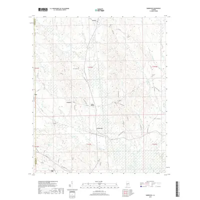
2018 Map of Kimbrough
USGS Topo · Published 2018About this map
The lowlands of western Wilcox County are defined by a network of creeks and small crossroads settlements, shown here in the late 2010s. Arlington and Kimbrough serve as central points in a landscape drained by Turkey Creek and Moccasin Cr, where the terrain transitions from the wetland sloughs of Peter Slough to rising timbered uplands. This area preserves a high density of small family and community burial grounds, such as Saint Matthews Cem, Thornhill Cem, and Collier Cem, which offer significant value for genealogical research in this part of the Alabama Black Belt.
Find a feature on this map
66 named features on this map. Tap any name to fly to it.
Don’t see what you’re looking for? This feature index may not catch every label — zoom into the map to look around manually.
Map Details
Editions of this 2018 Kimbrough Map
This is the sole edition of this map. No revisions or reprints were ever made.
Other maps of this area

1953 · Montgomery
USGS Topo · 1:250,000

1953 · Andalusia
USGS Topo · 1:250,000

1956 · Montgomery
USGS Topo · 1:250,000

1957 · Montgomery
USGS Topo · 1:250,000

1957 · Andalusia
USGS Topo · 1:250,000

1973 · Coy
USGS Topo · 1:24,000

1973 · Pine Hill
USGS Topo · 1:24,000

1973 · Thomasville
USGS Topo · 1:24,000

1974 · Catherine
USGS Topo · 1:24,000
1974 · Lee Long Bridge
USGS Topo · 1:24,000