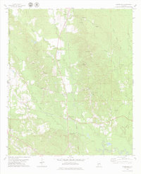
1978 Map of Kimbrough
USGS Topo · Published 1979About this map
The rail junction at Kimbrough serves as a focal point for this rural Wilcox County landscape during the late 1970s. Here, the Southern and ST Louis-San Francisco railroads intersect, shaping the movement of timber and goods across the coastal plain. The territory is defined by the winding paths of Turkey Creek and Goose Creek, where several small settlements like Arlington and Anne Manie have established themselves.
Find a feature on this map
52 named features on this map. Tap any name to fly to it.
Don’t see what you’re looking for? This feature index may not catch every label — zoom into the map to look around manually.
Map Details
Editions of this 1978 Kimbrough Map
This is the sole edition of this map. No revisions or reprints were ever made.
Other maps of this area

1953 · Montgomery
USGS Topo · 1:250,000

1953 · Andalusia
USGS Topo · 1:250,000

1956 · Montgomery
USGS Topo · 1:250,000

1957 · Montgomery
USGS Topo · 1:250,000

1957 · Andalusia
USGS Topo · 1:250,000

1973 · Coy
USGS Topo · 1:24,000

1973 · Pine Hill
USGS Topo · 1:24,000

1973 · Thomasville
USGS Topo · 1:24,000

1974 · Catherine
USGS Topo · 1:24,000
1974 · Lee Long Bridge
USGS Topo · 1:24,000