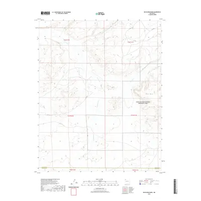
2020 Map of Kin Klizhin Ruins
USGS Topo · Published 2020About this map
Chaco Culture National Historical Park anchors the eastern portion of this high-desert landscape in New Mexico. The terrain is defined by a complex network of seasonal drainages, including the Chaco River, Kin Klizhin Wash, and Ah-Shi-Sle-Pah Wash. These arroyos carve through the dry earth near West Mesa, illustrating the geographic context of a region famous for its ancient Puebloan archaeological sites. The map documents the intersection of modern county infrastructure, such as Cty 7650 and Co Rd 7748, with the ancestral lands of the Navajo Agency. The boundary line between San Juan and McKinley Counties runs across the southern section, marking a modern political division across a landscape of significant cultural and geological antiquity.
Find a feature on this map
18 named features on this map. Tap any name to fly to it.
Don’t see what you’re looking for? This feature index may not catch every label — zoom into the map to look around manually.
Map Details
Editions of this 2020 Kin Klizhin Ruins Map
This is the sole edition of this map. No revisions or reprints were ever made.
Other maps of this area

1883 · Mt. Taylor
USGS Topo · 1:250,000

1886 · Wingate
USGS Topo · 1:250,000

1886 · Mt. Taylor
USGS Topo · 1:250,000

1889 · Largo
USGS Topo · 1:250,000

1889 · Chaco
USGS Topo · 1:250,000

1892 · Wingate
USGS Topo · 1:250,000

1892 · Chaco
USGS Topo · 1:250,000

1892 · Mt. Taylor
USGS Topo · 1:250,000

1895 · Largo
USGS Topo · 1:250,000

1899 · Mt. Taylor
USGS Topo · 1:250,000