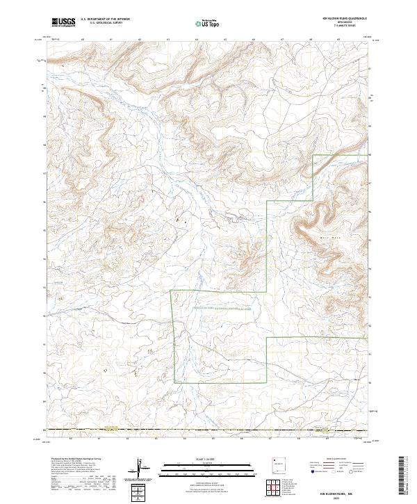
2023 Map of Kin Klizhin Ruins
USGS Topo · Published 2023About this map
Chaco Culture National Historical Park anchors the southern portion of this high-desert landscape, where the Kin Klizhin Wash and Chaco River converge. This arid drainage basin, straddling the San Juan and McKinley County line, is defined by significant topographical landmarks like West Mesa. The map records a network of ephemeral watercourses, including Ah-shi-sle-pah Wash, Chaco Wash, and Tse-ya-da-Wash, which have historically dictated human movement and settlement patterns in this region. Access to the archaeological and natural features is primarily provided by rural routes such as Co Rd 7748 and Co Rd 7875, showing the modern connectivity to this significant cultural corridor.
Find a feature on this map
18 named features on this map. Tap any name to fly to it.
Don’t see what you’re looking for? This feature index may not catch every label — zoom into the map to look around manually.
Map Details
Editions of this 2023 Kin Klizhin Ruins Map
This is the sole edition of this map. No revisions or reprints were ever made.
Other maps of this area

1883 · Mt. Taylor
USGS Topo · 1:250,000

1886 · Wingate
USGS Topo · 1:250,000

1886 · Mt. Taylor
USGS Topo · 1:250,000

1889 · Largo
USGS Topo · 1:250,000

1889 · Chaco
USGS Topo · 1:250,000

1892 · Wingate
USGS Topo · 1:250,000

1892 · Chaco
USGS Topo · 1:250,000

1892 · Mt. Taylor
USGS Topo · 1:250,000

1895 · Largo
USGS Topo · 1:250,000

1899 · Mt. Taylor
USGS Topo · 1:250,000