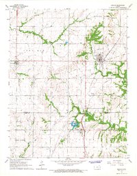
1966 Map of Kincaid
USGS Topo · Published 1967About this map
Kincaid and Lone Elm anchor this mid-1960s survey of eastern Kansas, a landscape shaped by the Missouri - Kansas - Texas Railroad and several historic burial grounds. The map reveals the community's rural foundation through features like Fairview Chapel and family-linked landmarks such as Mt Zion Cem and Lone Elm Cem. An abandoned Old Railroad Grade north of Kincaid suggests shifting transportation patterns, while the industrial character of the southern portion is marked by Mildred Lake and the small settlement of Mildred. The terrain is defined by the convergence of several waterways, including Deer Creek and the North Fork Little Osage River, which carve through the townships of North Rich and Lone Elm. Local industry is evidenced by scattered quarries and Oil Wells, providing a detailed look at the region's resource-based economy during this era.
Find a feature on this map
28 named features on this map. Tap any name to fly to it.
Don’t see what you’re looking for? This feature index may not catch every label — zoom into the map to look around manually.
Map Details
Editions of this 1966 Kincaid Map
2 editions found
Other maps of this area

1885 · Garnett
USGS Topo · 1:125,000

1886 · Iola
USGS Topo · 1:125,000

1893 · Iola
USGS Topo · 1:125,000

1894 · Garnett
USGS Topo · 1:125,000

1904 · Iola
USGS Topo · 1:125,000

1947 · Lawrence
USGS Topo · 1:250,000

1947 · Joplin
USGS Topo · 1:250,000

1949 · Joplin
USGS Topo · 1:250,000

1950 · Lawrence
USGS Topo · 1:250,000

1954 · Joplin
USGS Topo · 1:250,000