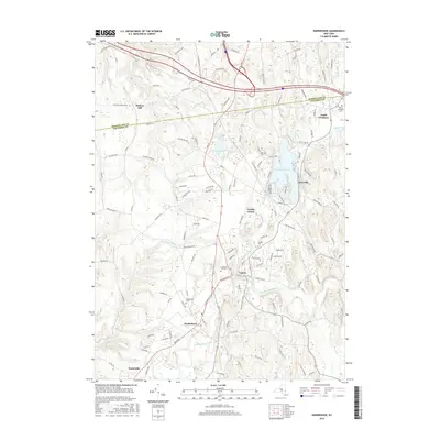
2016 Map of Kinderhook
USGS Topo · Published 2016About this map
Kinderhook Lake serves as a central geographic anchor for this part of the Hudson Valley, where the waters of the Valatie Kill and Kinderhook Creek converge. The landscape is defined by its historic creek-side settlements, including the village of Valatie and the larger town of Kinderhook. To the north, the small community of Muitzes Kill sits near the Rensselaer and Columbia county line, illustrating the traditional boundary divisions of the region. The map reveals a dense network of country roads such as Knickerbocker Rd and S Schodack Rd, which connect these inland villages to the surrounding farmsteads and hills. Local history is well-preserved through several dedicated burial grounds, including the North Chatham Cem, Valatie Cem, and Kinderhook Cem, which provide essential points of reference for genealogists tracing family roots in this established upstate corridor.
Find a feature on this map
131 named features on this map. Tap any name to fly to it.
Don’t see what you’re looking for? This feature index may not catch every label — zoom into the map to look around manually.
Map Details
Editions of this 2016 Kinderhook Map
This is the sole edition of this map. No revisions or reprints were ever made.
Other maps of this area

1893 · Troy
USGS Topo · 1:62,500

1893 · Coxsackie
USGS Topo · 1:62,500

1893 · Albany
USGS Topo · 1:62,500

1894 · Coxsackie
USGS Topo · 1:62,500

1895 · Troy
USGS Topo · 1:62,500

1895 · Albany
USGS Topo · 1:62,500

1898 · Albany
USGS Topo · 1:62,500

1898 · Troy
USGS Topo · 1:62,500

1903 · Kinderhook
USGS Topo · 1:62,500

1925 · Troy
USGS Topo · 1:48,000