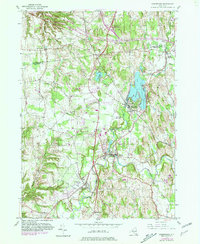
1980 Map of Kinderhook
USGS Topo · Published 1981About this map
The village of Kinderhook and its surroundings are captured here at a moment of transition, reflecting both its colonial heritage and its 20th-century growth. The map highlights the local significance of the House of History and the Ichabod Crane Community House, names that anchor the area to its literary and historical roots. The landscape is defined by the winding paths of the Valatie Kill and Kinderhook Creek, which converge near Valatie, once a hub of water-powered industry. Transportation networks shape the modern era, with the Taconic State Parkway cutting through the hills while the Conrail tracks trace older rail corridors. Residential pockets like Niverville on the shores of Kinderhook Lake and the smaller Sunnyside show the established settlement patterns of northern Columbia County. The inclusion of several Cemeteries and smaller hamlets like Muitzes Kill provides essential detail for researchers tracing family lineage in these Hudson Valley townships.
Find a feature on this map
24 named features on this map. Tap any name to fly to it.
Don’t see what you’re looking for? This feature index may not catch every label — zoom into the map to look around manually.
Map Details
Editions of this 1980 Kinderhook Map
This is the sole edition of this map. No revisions or reprints were ever made.
Other maps of this area

1893 · Troy
USGS Topo · 1:62,500

1893 · Coxsackie
USGS Topo · 1:62,500

1893 · Albany
USGS Topo · 1:62,500

1894 · Coxsackie
USGS Topo · 1:62,500

1895 · Troy
USGS Topo · 1:62,500

1895 · Albany
USGS Topo · 1:62,500

1898 · Albany
USGS Topo · 1:62,500

1898 · Troy
USGS Topo · 1:62,500

1903 · Kinderhook
USGS Topo · 1:62,500

1925 · Troy
USGS Topo · 1:48,000