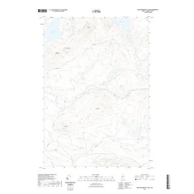
2021 Map of King And Bartlett Lake
USGS Topo · Published 2021About this map
King and Bartlett Lake and Spencer Lake anchor this Somerset County landscape, a territory defined by complex hydrography and high-elevation terrain. This survey reflects a modern view of a region historically vital to Maine's timber economy, where drainage patterns move through the Spencer Gut and along Little Spencer Stream. The topography is punctuated by prominent peaks including Bear Mtn, Pray Hill, and the notably named Black Nubble, creating a series of basins that collect in numerous smaller water bodies such as Beck Pond, Shaw Pond, and Cedar Pond. Access to this remote interior is documented via a network of forest management roads including Spencer Rd and Scott Rd, which wind around landmarks like Burnt Hill and the swampy expanse of Joe Pokum Bog. These roads and the proximity of Gore Rapids on Spencer Stream illustrate the rugged logistical reality of navigating this upland watershed.
Find a feature on this map
26 named features on this map. Tap any name to fly to it.
Don’t see what you’re looking for? This feature index may not catch every label — zoom into the map to look around manually.
Map Details
Editions of this 2021 King And Bartlett Lake Map
This is the sole edition of this map. No revisions or reprints were ever made.
Other maps of this area

1925 · Pierce Pond
USGS Topo · 1:48,000

1927 · Pierce Pond
USGS Topo · 1:62,500

1928 · Spencer
USGS Topo · 1:48,000

1928 · Dead River
USGS Topo · 1:62,500

1928 · Stratton
USGS Topo · 1:48,000

1931 · Dead River
USGS Topo · 1:48,000

1932 · Stratton
USGS Topo · 1:62,500

1932 · Spencer
USGS Topo · 1:62,500

1944 · Dead River
USGS Topo · 1:62,500

1944 · Pierce Pond
USGS Topo · 1:62,500
Featured Places
- T3 R5 BKP WKR, ME
- Spring Lake Township, ME
- King & Bartlett Township, ME
- Flagstaff Township, ME
- Somerset County, ME