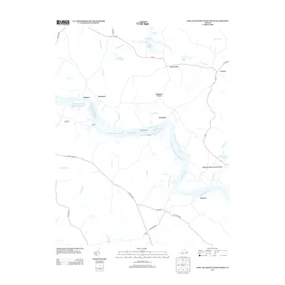
2013 Map of King And Queen Court House
USGS Topo · Published 2013About this map
The Mattaponi River carves a serpentine path through this rural Virginia landscape, defining the character of the Tidewater region. At the river's bend, the historic King and Queen Court House serves as a focal point for local governance and history. The surrounding terrain is a network of ecologically distinct wetlands, including Indian Town Swamp and Exol Swamp, alongside smaller water bodies like Ice House Pond and Indian Mound Ponds. Settlement patterns are scattered, featuring local centers such as Hillsboro, Mantapike, and Wakema. Historical river crossings and navigation points are evident through labels like Mantua Ferry, De Farges Bar, and Sandy Point. This 2013 survey illustrates the enduring relationship between the community and the river's shifting channels and low-lying marshes.
Find a feature on this map
38 named features on this map. Tap any name to fly to it.
Don’t see what you’re looking for? This feature index may not catch every label — zoom into the map to look around manually.
Map Details
Editions of this 2013 King And Queen Court House Map
This is the sole edition of this map. No revisions or reprints were ever made.
Other maps of this area

1918 · Tappahannock
USGS Topo · 1:62,500

1918 · Aylett
USGS Topo · 1:62,500

1919 · New Kent
USGS Topo · 1:62,500

1919 · Tappahannock
USGS Topo · 1:62,500

1920 · King William
USGS Topo · 1:62,500

1933 · Aylett
USGS Topo · 1:62,500

1943 · Richmond
USGS Topo · 1:250,000

1944 · Dunnsville
USGS Topo · 1:31,680
1944 · Howertons
USGS Topo · 1:24,000
1945 · Howertons
USGS Topo · 1:31,680