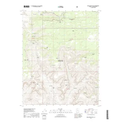
2018 Map of King Arthur Castle
USGS Topo · Published 2018About this map
Grand Canyon National Park and the Kaibab National Forest meet in this high-elevation landscape, where the Kaibab Plateau transitions into a network of dramatic canyons and named summits. This 2018 survey documents a remote portion of the North Rim where the Powell Plateau and Rainbow Plateau overlook a complex system of drainages, including Muav Canyon and Shinumo Cr. The nomenclature of the area is distinctively thematic, featuring landmarks such as Elaine Castle, Lancelot Point, and the Masonic Temple. Geologists and researchers can trace the course of White Cr as it flows past Holy Grail Temple toward the lower reaches of the canyon system. Water sources like South Big Spring and Powell Spring are critical points of interest in this arid, high-altitude environment, while the Natural Bridge near the Muav Saddle provides a specific focal point for topographic study.
Find a feature on this map
56 named features on this map. Tap any name to fly to it.
Don’t see what you’re looking for? This feature index may not catch every label — zoom into the map to look around manually.
Map Details
Editions of this 2018 King Arthur Castle Map
This is the sole edition of this map. No revisions or reprints were ever made.
Other maps of this area

1886 · Kaibab
USGS Topo · 1:250,000

1903 · Bright Angel
USGS Topo · 1:48,000

1906 · Bright Angel
USGS Topo · 1:48,000

1953 · Grand Canyon
USGS Topo · 1:250,000

1957 · Grand Canyon
USGS Topo · 1:250,000

1958 · Grand Canyon
USGS Topo · 1:250,000

1960 · Grand Canyon
USGS Topo · 1:250,000

1962 · Bright Angel
USGS Topo · 1:48,000

1962 · De Motte Park
USGS Topo · 1:62,500

1962 · Havasupai Point
USGS Topo · 1:62,500