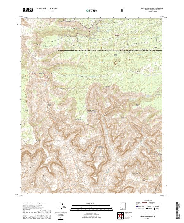
2021 Map of King Arthur Castle
USGS Topo · Published 2021About this map
Kaibab National Forest and Grand Canyon National Park converge in this high-plateau landscape, where the northern rim’s complex drainage patterns are carved into the limestone. The terrain is defined by massive formations such as the Shinumo Amphitheater and Elaine Castle, while the western edge is dominated by the sprawling Powell Plateau. This 2021 survey shows a wilderness largely accessed by traditional routes like the North Bass Trl and Powell Plateau Trl, which navigate between prominent overlooks like Fire Point and Dutton Point. Water sources are critical markers in this arid environment, with Powell Spring, Ikes Spring, and the seasonally variable Swamp Lake providing rare reliable points of interest for those studying the physical geography of the Coconino high country.
Find a feature on this map
57 named features on this map. Tap any name to fly to it.
Don’t see what you’re looking for? This feature index may not catch every label — zoom into the map to look around manually.
Map Details
Editions of this 2021 King Arthur Castle Map
This is the sole edition of this map. No revisions or reprints were ever made.
Other maps of this area

1886 · Kaibab
USGS Topo · 1:250,000

1903 · Bright Angel
USGS Topo · 1:48,000

1906 · Bright Angel
USGS Topo · 1:48,000

1953 · Grand Canyon
USGS Topo · 1:250,000

1957 · Grand Canyon
USGS Topo · 1:250,000

1958 · Grand Canyon
USGS Topo · 1:250,000

1960 · Grand Canyon
USGS Topo · 1:250,000

1962 · Bright Angel
USGS Topo · 1:48,000

1962 · De Motte Park
USGS Topo · 1:62,500

1962 · Havasupai Point
USGS Topo · 1:62,500