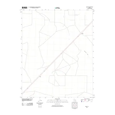
2010 Map of King
USGS Topo · Published 2010About this map
King and Rehm appear as small hubs in this high-plains landscape of Hartley County, connected by a network of ranch roads and a prominent diagonal rail line. The terrain is defined by the subtle drainage of Cottonwood Draw, which meanders through the eastern section of the quadrangle. Local transportation relies on routes like Kelly Rd, which cuts across the structured grid of sections common to this part of the Texas Panhandle. This survey provides a clear view of the sparse rural settlement patterns typical of the region, where large tracts of land are punctuated only by isolated sidings and the natural topography of dry creek beds.
Find a feature on this map
5 named features on this map. Tap any name to fly to it.
Don’t see what you’re looking for? This feature index may not catch every label — zoom into the map to look around manually.
Map Details
Editions of this 2010 King Map
This is the sole edition of this map. No revisions or reprints were ever made.
Other maps of this area

1954 · Tucumcari
USGS Topo · 1:250,000

1954 · Dalhart
USGS Topo · 1:250,000

1958 · Tucumcari
USGS Topo · 1:250,000

1958 · Dalhart
USGS Topo · 1:250,000

1962 · Dalhart
USGS Topo · 1:250,000

1971 · Middle Water
USGS Topo · 1:24,000

1971 · Syndicate Hills
USGS Topo · 1:24,000

1973 · Pardue Camp
USGS Topo · 1:24,000

1973 · King SW
USGS Topo · 1:24,000

1973 · King
USGS Topo · 1:24,000