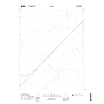
2019 Map of King
USGS Topo · Published 2019About this map
The settlement of King anchors this High Plains landscape in Hartley County, situated along a prominent transportation corridor that bisects the terrain. This rural expanse is defined by the ephemeral drainage of Cottonwood Draw in the east and a network of county roads including Middlewater Rd and Co Rd 24. The map reveals a highly structured division of land, with long straight-line boundaries and utility corridors typical of the Texas Panhandle's ranching and agricultural development. Topographic contours show a subtly undulating surface, where small depressions and drainage patterns like Cottonwood Draw provide the only breaks in the vast, open plateau. The modern alignment of Route 54 serves as the primary artery connecting this quiet corner of the state to the larger regional trade network.
Find a feature on this map
5 named features on this map. Tap any name to fly to it.
Don’t see what you’re looking for? This feature index may not catch every label — zoom into the map to look around manually.
Map Details
Editions of this 2019 King Map
This is the sole edition of this map. No revisions or reprints were ever made.
Other maps of this area

1954 · Tucumcari
USGS Topo · 1:250,000

1954 · Dalhart
USGS Topo · 1:250,000

1958 · Tucumcari
USGS Topo · 1:250,000

1958 · Dalhart
USGS Topo · 1:250,000

1962 · Dalhart
USGS Topo · 1:250,000

1971 · Middle Water
USGS Topo · 1:24,000

1971 · Syndicate Hills
USGS Topo · 1:24,000

1973 · Pardue Camp
USGS Topo · 1:24,000

1973 · King SW
USGS Topo · 1:24,000

1973 · King
USGS Topo · 1:24,000