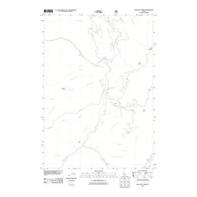
2011 Map of King Hill Creek
USGS Topo · Published 2011About this map
King Hill sits at the heart of this Idaho landscape, where the high-elevation terrain of Indian Mountain and Potato Knob gives way to a complex system of drainage basins. The area is defined by the headwaters and tributaries of the Little Weiser River, including King Hill Creek and Deer Creek. This 2011 survey illustrates a network of specialized forest roads, such as Nat For Dev Rd 217 and Little Weiser River Rd, which navigate the steep topography between Burnt Basin and the winding watercourses below. Historical land use is suggested by features like Telephone Spring and Telephone Draw, pointing to early utility corridors through the backcountry. The map serves as a detailed record of the hydrography and access routes within the Payette National Forest region before more recent shifts in forest management and road closures.
Find a feature on this map
27 named features on this map. Tap any name to fly to it.
Don’t see what you’re looking for? This feature index may not catch every label — zoom into the map to look around manually.
Map Details
Editions of this 2011 King Hill Creek Map
This is the sole edition of this map. No revisions or reprints were ever made.
Other maps of this area

1894 · Squaw Creek
USGS Topo · 1:125,000

1911 · Meadows
USGS Topo · 1:125,000

1953 · Smiths Ferry
USGS Topo · 1:62,500

1954 · Council
USGS Topo · 1:62,500

1954 · Cascade
USGS Topo · 1:62,500

1955 · Baker
USGS Topo · 1:250,000

1959 · Baker
USGS Topo · 1:250,000

1970 · Granger Butte
USGS Topo · 1:24,000
1970 · Twin Sisters
USGS Topo · 1:24,000

1980 · McCall
USGS Topo · 1:100,000