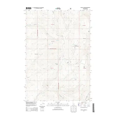
2013 Map of King Hill Creek
USGS Topo · Published 2013About this map
Payette National Forest dominates this Idaho-Adams County landscape, where the rugged topography is defined by the headwaters of numerous mountain creeks. The settlement of King Hill sits near the center of a complex hydrological network that includes King Hill Creek, Deer Creek, and Dog Creek. In the southern portion of the sheet, the Little Weiser River carves through the terrain, joined by tributaries such as Grouse Creek and Dry Creek. High-elevation landmarks like Indian Mountain, Potato Knob, and Burnt Basin provide distinct navigational points for those tracing the historic boundaries of townships T14N and T15N. The presence of features such as Telephone Spring and Telephone Draw suggest early communication or utility corridors through the forest, while remote drainages like Ross Gulch and Tiff Lindsay Draw point to the area's legacy of localized family naming and land use.
Find a feature on this map
33 named features on this map. Tap any name to fly to it.
Don’t see what you’re looking for? This feature index may not catch every label — zoom into the map to look around manually.
Map Details
Editions of this 2013 King Hill Creek Map
This is the sole edition of this map. No revisions or reprints were ever made.
Other maps of this area

1894 · Squaw Creek
USGS Topo · 1:125,000

1911 · Meadows
USGS Topo · 1:125,000

1953 · Smiths Ferry
USGS Topo · 1:62,500

1954 · Council
USGS Topo · 1:62,500

1954 · Cascade
USGS Topo · 1:62,500

1955 · Baker
USGS Topo · 1:250,000

1959 · Baker
USGS Topo · 1:250,000

1970 · Granger Butte
USGS Topo · 1:24,000
1970 · Twin Sisters
USGS Topo · 1:24,000

1980 · McCall
USGS Topo · 1:100,000