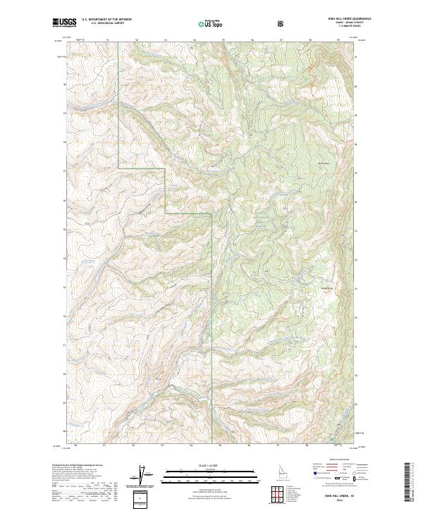
2024 Map of King Hill Creek
USGS Topo · Published 2024About this map
Payette National Forest encompasses the vast majority of this landscape in Adams County, defined by a complex drainage system feeding into the Little Weiser River. This 2024 survey captures the intricate network of forest development roads and primitive trails that provide access to the high-elevation terrain of the West Mountains. Notable landmarks like Potato Knob and Burnt Basin rise above the deep cuts of King Hill Creek and its various forks.
Find a feature on this map
38 named features on this map. Tap any name to fly to it.
Don’t see what you’re looking for? This feature index may not catch every label — zoom into the map to look around manually.
Map Details
Editions of this 2024 King Hill Creek Map
This is the sole edition of this map. No revisions or reprints were ever made.
Other maps of this area

1894 · Squaw Creek
USGS Topo · 1:125,000

1911 · Meadows
USGS Topo · 1:125,000

1953 · Smiths Ferry
USGS Topo · 1:62,500

1954 · Council
USGS Topo · 1:62,500

1954 · Cascade
USGS Topo · 1:62,500

1955 · Baker
USGS Topo · 1:250,000

1959 · Baker
USGS Topo · 1:250,000

1970 · Granger Butte
USGS Topo · 1:24,000
1970 · Twin Sisters
USGS Topo · 1:24,000

1980 · McCall
USGS Topo · 1:100,000