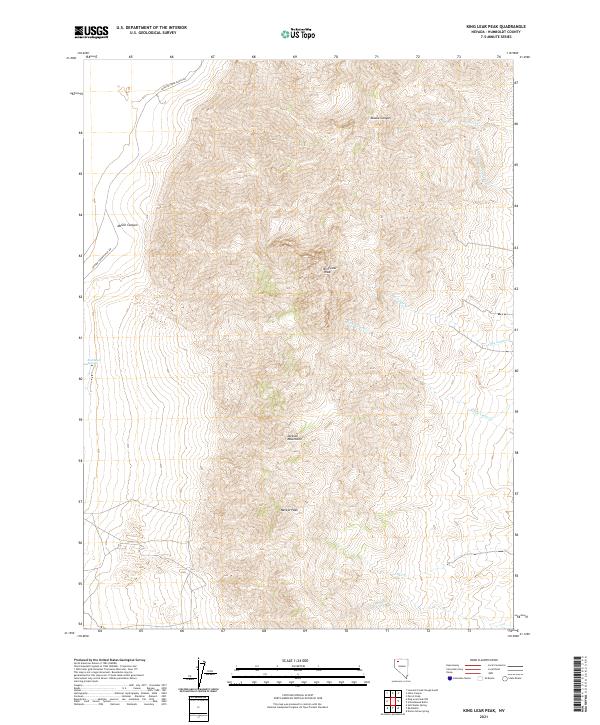
2021 Map of King Lear Peak
USGS Topo · Published 2021About this map
King Lear Peak serves as the prominent high point in this section of the Jackson Mountains within Humboldt County. The terrain is defined by a series of steep drainages including McGill Canyon and Alaska Canyon, which feed into the surrounding desert basins. Water sources are scarce in this arid environment, marked by the presence of Buckbrush Springs and several seasonal watercourses like Clover Cr, Big Cedar Cr, and Little Cedar Cr. Evidence of high-altitude land management is found in the survey lines for t39n r31e and surrounding townships, while the Jackson Creek Ranch Rd provides one of the few established access points into these mountains. The map also captures Navajo Peak, illustrating the complex topography of the range before it transitions into the lower elevations where Bull Cr and Post Cr are situated.
Find a feature on this map
16 named features on this map. Tap any name to fly to it.
Don’t see what you’re looking for? This feature index may not catch every label — zoom into the map to look around manually.
Map Details
Editions of this 2021 King Lear Peak Map
This is the sole edition of this map. No revisions or reprints were ever made.
Other maps of this area

1886 · Disaster
USGS Topo · 1:250,000

1893 · Disaster
USGS Topo · 1:250,000

1954 · Vya
USGS Topo · 1:250,000

1958 · Vya
USGS Topo · 1:250,000

1961 · Bottle Creek
USGS Topo · 1:62,500

1962 · Vya
USGS Topo · 1:250,000

1966 · Donna Schee Peak
USGS Topo · 1:62,500

1966 · King Lear Peak
USGS Topo · 1:62,500

1972 · Hobo Canyon
USGS Topo · 1:24,000
1972 · Leonard Cr. Slough South
USGS Topo · 1:24,000