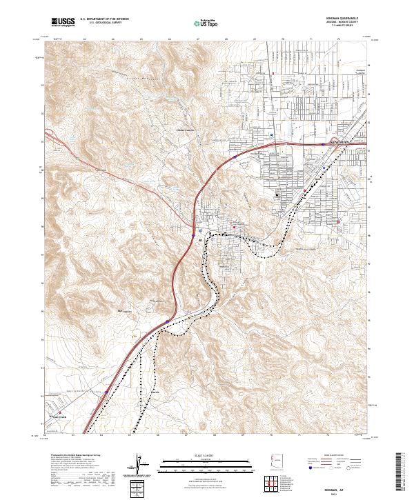
2021 Map of Kingman
USGS Topo · Published 2021About this map
The Mohave County Courthouse serves as a central landmark for this modern detailed survey of northwestern Arizona. The settlement of Kingman transitions from an urban grid into the vast terrain of the Cerbat Mountains and the Hualapai Valley. This 2021 record captures the complex transportation network where W Beale St, Oatman Rd, and the Old Trails Rd converge. A cluster of historic water sources, including Beale Spring and Atlantic Spring, are documented at the edge of the Mojave Desert, marking sites that have supported regional transit for generations. Beyond the city center, the map identifies residential and industrial pockets like Getz, McConnico, and Harris, alongside the Mountain View Cem and the drainages of Slaughterhouse Canyon and Sawmill Canyon.
Find a feature on this map
47 named features on this map. Tap any name to fly to it.
Don’t see what you’re looking for? This feature index may not catch every label — zoom into the map to look around manually.
Map Details
Editions of this 2021 Kingman Map
This is the sole edition of this map. No revisions or reprints were ever made.
Historical Maps of McConnico Through Time
8 maps found