
1947 Map of Kingman
USGS Topo · Published 1948About this map
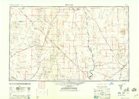
Kingman serves as the eastern anchor in this post-war landscape, situated at the junction of U S 66 and the Atchison Topeka and Santa Fe railroad. The map documents the intricate borderlands of Arizona, Nevada, and California, defined by the winding course of the Colorado River and the newly established Lake Mead National Recreational Area. Mining history is heavily concentrated in the mountains, with sites like the Copper World Mine and Turquoise Mine appearing alongside established mining districts such as Oatman and Goldroad. To the west, the Union Pacific railroad cuts through the arid basins, connecting small rail stops like Nipton and Kelso across the Ivanpah Valley. Aviation infrastructure of the era is also visible near the Nevada border, including the Searchlight Emergency Field and the Searchlight Flight Strip.
Find a feature on this map
114 named features on this map. Tap any name to fly to it.
Don’t see what you’re looking for? This feature index may not catch every label — zoom into the map to look around manually.
Map Details
Editions of this 1947 Kingman Map
2 editions found
Other maps of this area

1886 · Diamond Creek
USGS Topo · 1:250,000

1886 · Camp Mohave
USGS Topo · 1:250,000

1886 · Saint Thomas
USGS Topo · 1:250,000

1886 · Mt. Trumbull
USGS Topo · 1:250,000

1892 · Diamond Creek
USGS Topo · 1:250,000

1892 · Mt. Trumbull
USGS Topo · 1:250,000

1892 · Camp Mohave
USGS Topo · 1:250,000

1893 · Saint Thomas
USGS Topo · 1:250,000

1903 · Needles
USGS Topo · 1:125,000

1904 · Needles Special
USGS Topo · 1:125,000