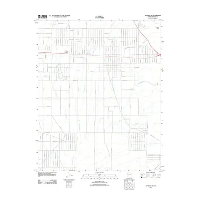
2011 Map of Kingman NW
USGS Topo · Published 2011About this map
Golden Valley serves as the central hub of this Mojave desert landscape, characterized by an expansive grid of residential roads that emphasize the community's late 20th-century growth. The terrain is defined by significant drainage systems, including the Cerbat Wash, Thirteenmile Wash, and Sacramento Wash, which illustrate the hydrological patterns essential to life in this arid basin. To the northeast, Castle Rock stands as a prominent geological landmark overlooking the developing valley floors. The map reveals an intricate network of named thoroughfares such as Old Coyote Pass Rd and Destiny Way, alongside uniquely named desert routes like Shinarump Dr and Chuar. These labels reflect both the local topography and the geological terminology used by surveyors to identify the various strata and formations common to the Arizona high desert.
Find a feature on this map
37 named features on this map. Tap any name to fly to it.
Don’t see what you’re looking for? This feature index may not catch every label — zoom into the map to look around manually.
Map Details
Editions of this 2011 Kingman NW Map
This is the sole edition of this map. No revisions or reprints were ever made.
Other maps of this area

1886 · Camp Mohave
USGS Topo · 1:250,000

1892 · Camp Mohave
USGS Topo · 1:250,000

1939 · Chloride
USGS Topo · 1:48,000

1942 · Camp Mohave
USGS Topo · 1:250,000

1944 · Chloride
USGS Topo · 1:62,500

1947 · Kingman
USGS Topo · 1:250,000

1948 · Kingman
USGS Topo · 1:250,000

1954 · Kingman
USGS Topo · 1:250,000

1955 · Kingman
USGS Topo · 1:250,000

1958 · Kingman
USGS Topo · 1:250,000