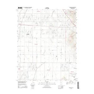
2014 Map of Kingman NW
USGS Topo · Published 2014About this map
Golden Valley serves as a primary settlement hub in this part of the Mojave Desert, where a grid of residential roads meets the natural drainage of the Cerbat Wash. The landscape is defined by the transition from the arid flats of the Sacramento Valley toward the more varied terrain near Castle Rock and the So-Hi community. Transportation is anchored by Az-68, which cuts through the heart of the valley, and the historic Oatman Hwy visible in the southern reaches near Walnut Creek. The drainage patterns are clearly delineated through systems like Thirteenmile Wash and Sacramento Wash, illustrating how water management and terrain dictate the layout of this high-desert community. Researchers can observe the intersection of modern suburban planning with the open desert environment as it existed in the early 2010s.
Find a feature on this map
48 named features on this map. Tap any name to fly to it.
Don’t see what you’re looking for? This feature index may not catch every label — zoom into the map to look around manually.
Map Details
Editions of this 2014 Kingman NW Map
This is the sole edition of this map. No revisions or reprints were ever made.
Other maps of this area

1886 · Camp Mohave
USGS Topo · 1:250,000

1892 · Camp Mohave
USGS Topo · 1:250,000

1939 · Chloride
USGS Topo · 1:48,000

1942 · Camp Mohave
USGS Topo · 1:250,000

1944 · Chloride
USGS Topo · 1:62,500

1947 · Kingman
USGS Topo · 1:250,000

1948 · Kingman
USGS Topo · 1:250,000

1954 · Kingman
USGS Topo · 1:250,000

1955 · Kingman
USGS Topo · 1:250,000

1958 · Kingman
USGS Topo · 1:250,000