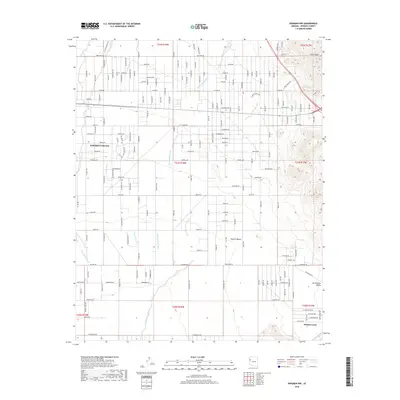
2018 Map of Kingman NW
USGS Topo · Published 2018About this map
Golden Valley and the surrounding Mojave Desert are depicted in this 2018 survey, which reveals the grid-like residential development expanding across the arid landscape of Mohave County. The settlement patterns are defined by a complex network of named roads such as Santa Maria Rd, Liguerta Rd, and Verde Rd, reflecting modern rural subdivision growth. The terrain is characterized by large drainage systems, including Thirteenmile Wash and Cerbat Wash, which traverse the area toward the Sacramento Valley. In the northeast, the elevation rises sharply toward Castle Rock, providing a stark contrast to the alluvial plains below. To the southeast, the residential cluster of Walnut Creek sits near the base of the mountains, illustrating how the community has adapted to the natural topography of the high desert basin.
Find a feature on this map
149 named features on this map. Tap any name to fly to it.
Don’t see what you’re looking for? This feature index may not catch every label — zoom into the map to look around manually.
Map Details
Editions of this 2018 Kingman NW Map
This is the sole edition of this map. No revisions or reprints were ever made.
Other maps of this area

1886 · Camp Mohave
USGS Topo · 1:250,000

1892 · Camp Mohave
USGS Topo · 1:250,000

1939 · Chloride
USGS Topo · 1:48,000

1942 · Camp Mohave
USGS Topo · 1:250,000

1944 · Chloride
USGS Topo · 1:62,500

1947 · Kingman
USGS Topo · 1:250,000

1948 · Kingman
USGS Topo · 1:250,000

1954 · Kingman
USGS Topo · 1:250,000

1955 · Kingman
USGS Topo · 1:250,000

1958 · Kingman
USGS Topo · 1:250,000