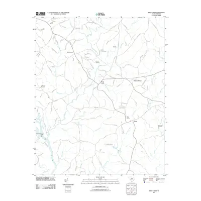
2011 Map of Kings Creek
USGS Topo · Published 2011About this map
Kings Creek and Smyrna anchor this rural landscape in the Upstate region, where small-scale farming and quiet settlements remain the primary focus. The area is heavily defined by its complex drainage network, where Bells Branch and Wolf Creek feed into the prominent Broad River. Local genealogy is deeply etched into the land through numerous small burial grounds, including the Goode Cemetery in the north and the Mount Sinai Cemetery near the southern edge. The presence of Piedmont Springs suggests a historical connection to the region's mineral spring traditions. Industrial and utility infrastructure is represented by the Ninety-nine Island Dam on the river, while natural landmarks like Jefferson Mountain provide topographic relief. The map reveals a high density of named roads and family-linked features like the Bialock Cemetery, indicating a well-established community fabric that has persisted through the decades.
Find a feature on this map
120 named features on this map. Tap any name to fly to it.
Don’t see what you’re looking for? This feature index may not catch every label — zoom into the map to look around manually.
Map Details
Editions of this 2011 Kings Creek Map
This is the sole edition of this map. No revisions or reprints were ever made.
Other maps of this area

1906 · Kings Mountain
USGS Topo · 1:62,500

1907 · Sharon
USGS Topo · 1:62,500

1908 · Kings Mountain
USGS Topo · 1:62,500

1909 · Gaffney
USGS Topo · 1:62,500

1941 · Spartanburg
USGS Topo · 1:250,000

1953 · Spartanburg
USGS Topo · 1:250,000

1953 · Charlotte
USGS Topo · 1:250,000

1954 · Charlotte
USGS Topo · 1:250,000

1960 · Charlotte
USGS Topo · 1:250,000

1960 · Spartanburg
USGS Topo · 1:250,000