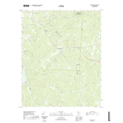
2020 Map of Kings Creek
USGS Topo · Published 2020About this map
Kings Mountain National Military Park dominates the northeast corner of this map, preserving a landscape of significant American Revolutionary War memory. To the south, the terrain transitions into a web of rural roads and watercourses including Kings Creek and the Broad River. Local history is deeply etched into the land through numerous family and congregational burial grounds, such as Hopewell Presbyterian Church Graveyard and Mount Sinai Cem. The small settlements of Smyrna and Kings Creek serve as anchors for the surrounding agricultural and wooded landscape. Genealogists will find interest in the dispersed cemeteries like Ellis Cem and Heathcock Cem, which mark the lineages of the families who settled this border region between Cherokee and York counties.
Find a feature on this map
118 named features on this map. Tap any name to fly to it.
Don’t see what you’re looking for? This feature index may not catch every label — zoom into the map to look around manually.
Map Details
Editions of this 2020 Kings Creek Map
This is the sole edition of this map. No revisions or reprints were ever made.
Other maps of this area

1906 · Kings Mountain
USGS Topo · 1:62,500

1907 · Sharon
USGS Topo · 1:62,500

1908 · Kings Mountain
USGS Topo · 1:62,500

1909 · Gaffney
USGS Topo · 1:62,500

1941 · Spartanburg
USGS Topo · 1:250,000

1953 · Spartanburg
USGS Topo · 1:250,000

1953 · Charlotte
USGS Topo · 1:250,000

1954 · Charlotte
USGS Topo · 1:250,000

1960 · Charlotte
USGS Topo · 1:250,000

1960 · Spartanburg
USGS Topo · 1:250,000