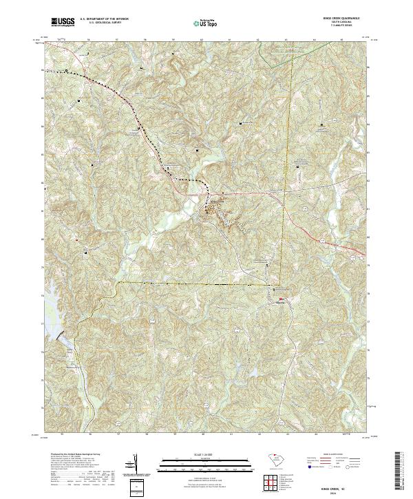
2024 Map of Kings Creek
USGS Topo · Published 2024About this map
Kings Mountain National Military Park dominates the northern corner of this landscape, marking a site of deep historical significance along the Cherokee Co and York Co line. The settlement of Kings Creek and the small town of Smyrna serve as local hubs, connected by a network of rural routes like McGill Hwy and Old Yorkville Rd. The terrain is defined by the winding course of the Broad River, where river crossings like Island Ferry and Bordens Ferry once facilitated movement across the water.
Find a feature on this map
119 named features on this map. Tap any name to fly to it.
Don’t see what you’re looking for? This feature index may not catch every label — zoom into the map to look around manually.
Map Details
Editions of this 2024 Kings Creek Map
This is the sole edition of this map. No revisions or reprints were ever made.
Other maps of this area

1906 · Kings Mountain
USGS Topo · 1:62,500

1907 · Sharon
USGS Topo · 1:62,500

1908 · Kings Mountain
USGS Topo · 1:62,500

1909 · Gaffney
USGS Topo · 1:62,500

1941 · Spartanburg
USGS Topo · 1:250,000

1953 · Spartanburg
USGS Topo · 1:250,000

1953 · Charlotte
USGS Topo · 1:250,000

1954 · Charlotte
USGS Topo · 1:250,000

1960 · Charlotte
USGS Topo · 1:250,000

1960 · Spartanburg
USGS Topo · 1:250,000