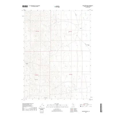
2018 Map of Kings River Ranch
USGS Topo · Published 2018About this map
Kings River Ranch and the broader Kings River Valley define this portion of Humboldt County, where agricultural life meets the high desert. The landscape transitions from the riparian corridor of the Kings River to the steep eastern slopes of the Bilk Creek Mountains. This 2018 survey reveals a network of water sources vital to ranching in the Great Basin, including Warm Spring, Fivemile Spring, and the ephemeral courses of Dry Cr and House Cr. The relief is most dramatic in the western half of the map, where Black Canyon and Agate Point rise sharply above the basin floor. Local transportation remains centered on the gravel and dirt arteries of Kings River Rd and Bengoa Rd, which connect these remote operations to the wider region.
Find a feature on this map
22 named features on this map. Tap any name to fly to it.
Don’t see what you’re looking for? This feature index may not catch every label — zoom into the map to look around manually.
Map Details
Editions of this 2018 Kings River Ranch Map
This is the sole edition of this map. No revisions or reprints were ever made.
Other maps of this area

1886 · Disaster
USGS Topo · 1:250,000

1893 · Disaster
USGS Topo · 1:250,000

1954 · Vya
USGS Topo · 1:250,000

1958 · Vya
USGS Topo · 1:250,000

1961 · Quinn River Crossing
USGS Topo · 1:62,500

1961 · Thacker Pass
USGS Topo · 1:62,500

1961 · Trident Peak
USGS Topo · 1:62,500

1961 · Disaster Peak
USGS Topo · 1:62,500

1962 · Vya
USGS Topo · 1:250,000

1979 · Denio
USGS Topo · 1:100,000