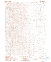
1990 Map of Kings River Ranch
USGS Topo · Published 1990About this map
Kings River Ranch anchors the high desert landscape of Humboldt County, positioned along the edge of the Kings River Valley. This 1990 provisional survey documents the transition from the alluvial floor to the towering Bilk Creek Mountains, which dominate the western half of the quadrangle. The map captures an arid environment where water sources like Fivemile Spring and ephemeral drainages such as Bilk Creek and Cherry Creek dictate the layout of cattle ranching operations and isolated tracks. The rugged western slopes are marked by geographic features like Agate Point and the deep incision of Black Canyon, while the eastern side follows the course of the Kings River. This topography reflects the late 20th-century character of Nevada’s Great Basin, showing a landscape defined by sparse human settlement and significant elevation changes.
Find a feature on this map
12 named features on this map. Tap any name to fly to it.
Don’t see what you’re looking for? This feature index may not catch every label — zoom into the map to look around manually.
Map Details
Editions of this 1990 Kings River Ranch Map
This is the sole edition of this map. No revisions or reprints were ever made.
Other maps of this area

1886 · Disaster
USGS Topo · 1:250,000

1893 · Disaster
USGS Topo · 1:250,000

1954 · Vya
USGS Topo · 1:250,000

1958 · Vya
USGS Topo · 1:250,000

1961 · Quinn River Crossing
USGS Topo · 1:62,500

1961 · Thacker Pass
USGS Topo · 1:62,500

1961 · Trident Peak
USGS Topo · 1:62,500

1961 · Disaster Peak
USGS Topo · 1:62,500

1962 · Vya
USGS Topo · 1:250,000

1979 · Denio
USGS Topo · 1:100,000