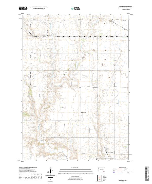
2021 Map of Kingsburg
USGS Topo · Published 2021About this map
Emanuel Cr and Little Emanuel Cr meander through this section of Bon Homme County, defining a rural landscape of section-line roads and scattered agricultural settlements. The small community of Kingsburg sits near the center of the map, while larger hubs like Tyndall and Springfield are visible at the periphery. This modern survey is particularly valuable for genealogists, as it meticulously identifies numerous burial sites throughout the townships, including Saint Leo Cem, Tyndall Cem, and Saint Vincents Cem. Local history researchers will also find landmarks of rural infrastructure such as Niles School Rd and the Springfield Municipal Airport, which illustrate the long-term patterns of land use and transportation in this part of South Dakota.
Find a feature on this map
32 named features on this map. Tap any name to fly to it.
Don’t see what you’re looking for? This feature index may not catch every label — zoom into the map to look around manually.
Map Details
Editions of this 2021 Kingsburg Map
This is the sole edition of this map. No revisions or reprints were ever made.
Other maps of this area

1898 · Olivet
USGS Topo · 1:125,000

1950 · Niobrara
USGS Topo · 1:24,000

1955 · Sioux City
USGS Topo · 1:250,000

1955 · Sioux Falls
USGS Topo · 1:250,000

1955 · Mitchell
USGS Topo · 1:250,000

1955 · O'Neill
USGS Topo · 1:250,000

1958 · Sioux City
USGS Topo · 1:250,000

1958 · Sioux Falls
USGS Topo · 1:250,000

1959 · O'Neill
USGS Topo · 1:250,000

1959 · Sioux City
USGS Topo · 1:250,000