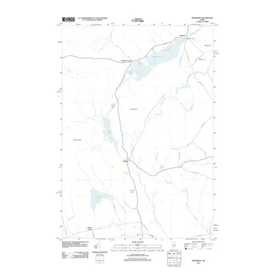
2011 Map of Kingsbury
USGS Topo · Published 2011About this map
Kingsbury Dam sits at the northern end of Mayfield Pond, anchoring a landscape defined by small Maine settlements and a network of interior waterways. The village of Kingsbury is situated near the outlet of Kingsbury Stream, while further south, the settlement of Brighton serves as a central point for local travel along Old Kingsbury Rd and Solon Rd. This 2011 survey reveals a region of significant elevation, dominated by Foss Mountain and Kelly Mountain, with the topography descending into drainage basins like Wyman Pond and Prentiss Pond. Genealogists may find interest in Foss Hill Cemetery near Whittier Hill, while the distribution of corners—including Mayfield Corner and Moody Corner—illustrates the traditional rural crossroad development pattern common to Somerset County.
Find a feature on this map
43 named features on this map. Tap any name to fly to it.
Don’t see what you’re looking for? This feature index may not catch every label — zoom into the map to look around manually.
Map Details
Editions of this 2011 Kingsbury Map
This is the sole edition of this map. No revisions or reprints were ever made.
Other maps of this area

1903 · Bingham
USGS Topo · 1:62,500

1904 · Anson
USGS Topo · 1:62,500

1905 · Bingham
USGS Topo · 1:62,500

1913 · Skowhegan
USGS Topo · 1:62,500

1948 · Bangor
USGS Topo · 1:250,000

1948 · Kingsbury
USGS Topo · 1:62,500

1950 · Kingsbury
USGS Topo · 1:62,500

1954 · Millinocket
USGS Topo · 1:250,000

1955 · Anson
USGS Topo · 1:62,500

1955 · Skowhegan
USGS Topo · 1:62,500