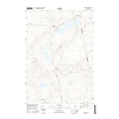
2014 Map of Kingsbury
USGS Topo · Published 2014About this map
Brighton and Kingsbury anchor this rural landscape in Somerset County, where the transition from dense forest to small settlements is defined by a network of waterways and early road systems. The terrain is punctuated by significant elevations like Foss Hill and Foss Mtn, which overlook a series of glacial water bodies including Mayfield Pond, Wyman Pond, and the smaller Otter Pond. The mapping reveals the historical footprint of early settlers through family-named landmarks and infrastructure, such as the Foss Hill Cem and Flanders Cem.
Find a feature on this map
57 named features on this map. Tap any name to fly to it.
Don’t see what you’re looking for? This feature index may not catch every label — zoom into the map to look around manually.
Map Details
Editions of this 2014 Kingsbury Map
This is the sole edition of this map. No revisions or reprints were ever made.
Other maps of this area

1903 · Bingham
USGS Topo · 1:62,500

1904 · Anson
USGS Topo · 1:62,500

1905 · Bingham
USGS Topo · 1:62,500

1913 · Skowhegan
USGS Topo · 1:62,500

1948 · Bangor
USGS Topo · 1:250,000

1948 · Kingsbury
USGS Topo · 1:62,500

1950 · Kingsbury
USGS Topo · 1:62,500

1954 · Millinocket
USGS Topo · 1:250,000

1955 · Anson
USGS Topo · 1:62,500

1955 · Skowhegan
USGS Topo · 1:62,500