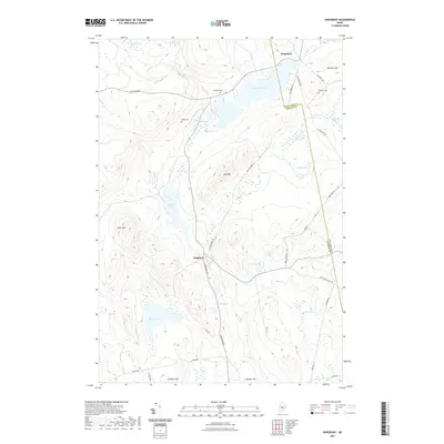
2021 Map of Kingsbury
USGS Topo · Published 2021About this map
Brighton and Kingsbury anchor this interior Maine landscape, where the county line between Piscataquis and Somerset counties runs through a terrain dominated by bogs and high peaks. The region is defined by a heavy concentration of water bodies, including Mayfield Pond, Wyman Pond, and Smith Pond, interspersed with expansive wetlands like Whitman Bog and Scribner Bog. The settlement pattern follows established routes like Brighton Rd and Kingsbury Rd, which connect the small villages to the surrounding timberlands and hills. Local history is preserved in small, family-named burial grounds such as Flanders Cem, Kelley Cem, and Foss Hill Cem, while topographic landmarks like Foss Mtn and Kelly Mtn provide significant vertical relief. The presence of Old Kingsbury Rd suggests the historical pathways once used to navigate these uplands before modern highway alignments.
Find a feature on this map
41 named features on this map. Tap any name to fly to it.
Don’t see what you’re looking for? This feature index may not catch every label — zoom into the map to look around manually.
Map Details
Editions of this 2021 Kingsbury Map
This is the sole edition of this map. No revisions or reprints were ever made.
Other maps of this area

1903 · Bingham
USGS Topo · 1:62,500

1904 · Anson
USGS Topo · 1:62,500

1905 · Bingham
USGS Topo · 1:62,500

1913 · Skowhegan
USGS Topo · 1:62,500

1948 · Bangor
USGS Topo · 1:250,000

1948 · Kingsbury
USGS Topo · 1:62,500

1950 · Kingsbury
USGS Topo · 1:62,500

1954 · Millinocket
USGS Topo · 1:250,000

1955 · Anson
USGS Topo · 1:62,500

1955 · Skowhegan
USGS Topo · 1:62,500