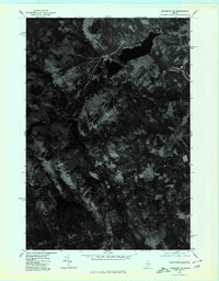
1975 Map of Kingsbury SW
USGS Topo · Published 1980About this map
Kingsbury and the surrounding Somerset County highlands are captured here in an orthophotographic study from the mid-1970s. This specific type of imagery, prepared from 1:80,000-scale aerial photography taken in late October, provides a direct visual record of the land surface, revealing the density of forest cover and the precise layout of small settlements like Brighton and Mayfield Corner. The terrain is dominated by significant elevations including Foss Mountain and Bald Mountain, which dictate the sparse road network and settlement patterns of this upland region. Unlike a standard topographic map, this photoimagery allows for the identification of clearings and land use changes that are often simplified into symbols on traditional maps, offering a raw view of the landscape during a period of transition in Maine's interior.
Find a feature on this map
5 named features on this map. Tap any name to fly to it.
Don’t see what you’re looking for? This feature index may not catch every label — zoom into the map to look around manually.
Map Details
Editions of this 1975 Kingsbury SW Map
This is the sole edition of this map. No revisions or reprints were ever made.
Other maps of this area

1903 · Bingham
USGS Topo · 1:62,500

1904 · Anson
USGS Topo · 1:62,500

1905 · Bingham
USGS Topo · 1:62,500

1913 · Skowhegan
USGS Topo · 1:62,500

1948 · Bangor
USGS Topo · 1:250,000

1948 · Kingsbury
USGS Topo · 1:62,500

1950 · Kingsbury
USGS Topo · 1:62,500

1954 · Millinocket
USGS Topo · 1:250,000

1955 · Anson
USGS Topo · 1:62,500

1955 · Skowhegan
USGS Topo · 1:62,500