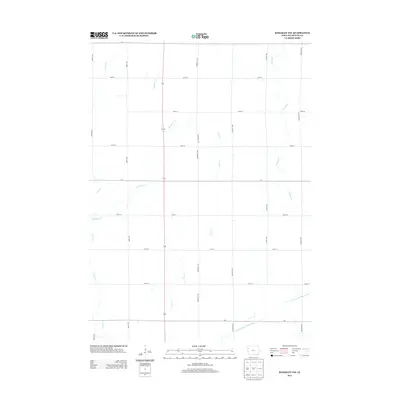
2013 Map of Kingsley NW
USGS Topo · Published 2013About this map
The W Fork Little Sioux River winds through the southeastern corner of this Plymouth County landscape, anchoring a drainage system that includes several named tributaries. The terrain is structured by a rigid section-line grid of rural roads, including Quartz Ave, Roosevelt Ave, and Tamarack Ave. This agricultural expanse is defined by the paths of Whisky Cr and Rathburn Cr, which cut diagonally across the survey area. As a 2013 topographic study, the map records the contemporary footprint of these rural corridors and waterways, offering a precise look at the modern drainage patterns and the network of local connectors like Quest Ave and Shamrock Ave that facilitate movement across the prairie.
Find a feature on this map
20 named features on this map. Tap any name to fly to it.
Don’t see what you’re looking for? This feature index may not catch every label — zoom into the map to look around manually.
Map Details
Editions of this 2013 Kingsley NW Map
This is the sole edition of this map. No revisions or reprints were ever made.
Other maps of this area

1954 · Fort Dodge
USGS Topo · 1:250,000

1955 · Sioux City
USGS Topo · 1:250,000

1957 · Fort Dodge
USGS Topo · 1:250,000

1958 · Sioux City
USGS Topo · 1:250,000

1958 · Fort Dodge
USGS Topo · 1:250,000

1959 · Sioux City
USGS Topo · 1:250,000

1962 · Le Mars
USGS Topo · 1:62,500

1962 · Union Center
USGS Topo · 1:62,500

1969 · Pierson
USGS Topo · 1:24,000

1969 · Fielding
USGS Topo · 1:24,000