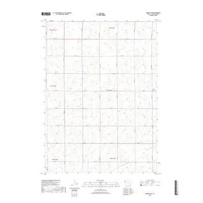
2018 Map of Kingsley NW
USGS Topo · Published 2018About this map
The West Fork Little Sioux River carves through the southeastern corner of this Plymouth County landscape, where the agricultural grid meets a winding network of local waterways. This 2018 survey captures the rural character of the region, anchored by the Pleasant Hill Cem near the eastern boundary. The terrain is defined by the drainage patterns of Whisky Cr, Rathburn Cr, and Deer Cr, which disrupt the otherwise orderly layout of section roads like Co Rd C44 and Tamarack Ave. Genealogists and local historians can trace the legacy of early land divisions through the well-preserved Public Land Survey System boundaries, while the placement of Johns Cr and various unnamed tributaries illustrates the natural challenges faced by settlers establishing the farmsteads that have long shaped this part of Iowa.
Find a feature on this map
29 named features on this map. Tap any name to fly to it.
Don’t see what you’re looking for? This feature index may not catch every label — zoom into the map to look around manually.
Map Details
Editions of this 2018 Kingsley NW Map
This is the sole edition of this map. No revisions or reprints were ever made.
Other maps of this area

1954 · Fort Dodge
USGS Topo · 1:250,000

1955 · Sioux City
USGS Topo · 1:250,000

1957 · Fort Dodge
USGS Topo · 1:250,000

1958 · Sioux City
USGS Topo · 1:250,000

1958 · Fort Dodge
USGS Topo · 1:250,000

1959 · Sioux City
USGS Topo · 1:250,000

1962 · Le Mars
USGS Topo · 1:62,500

1962 · Union Center
USGS Topo · 1:62,500

1969 · Pierson
USGS Topo · 1:24,000

1969 · Fielding
USGS Topo · 1:24,000