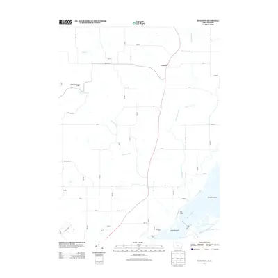
2013 Map of Kingston
USGS Topo · Published 2013About this map
Kingston and the small settlement of Latty occupy the upland plains of Des Moines County, where the landscape transitions toward the expansive bottomlands of the Mississippi River. This reach of the river is defined by a complex network of secondary channels and islands, including Big Dasher Island, Rag Island, and Little Rag Island. Tributaries like Dolbee Cr and the meandering Yellow Spring Creek carve through the terrain, with the latter crossed by the Yellow Spring Creek Bridge near the intersection of Sperry Rd. The map illustrates a contemporary rural infrastructure where ancient watercourses like Old Channel Henderson Creek persist alongside modern recreational points such as the Tama Beach Access and Edgewater Beach Access. The grid of county roads, including the notably named Pegtown Rd and Meekers Landing Rd, reflects a long-established agricultural pattern typical of southeastern Iowa.
Find a feature on this map
60 named features on this map. Tap any name to fly to it.
Don’t see what you’re looking for? This feature index may not catch every label — zoom into the map to look around manually.
Map Details
Editions of this 2013 Kingston Map
This is the sole edition of this map. No revisions or reprints were ever made.
Other maps of this area

1934 · Oquawka
USGS Topo · 1:48,000

1934 · Burlington
USGS Topo · 1:48,000

1935 · Keithsburg
USGS Topo · 1:48,000

1940 · Oquawka
USGS Topo · 1:62,500

1940 · Burlington
USGS Topo · 1:62,500

1941 · Keithsburg
USGS Topo · 1:62,500

1946 · Wapello
USGS Topo · 1:62,500

1949 · Wapello
USGS Topo · 1:62,500

1958 · Burlington
USGS Topo · 1:250,000

1958 · Davenport
USGS Topo · 1:250,000