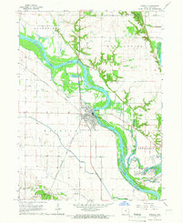
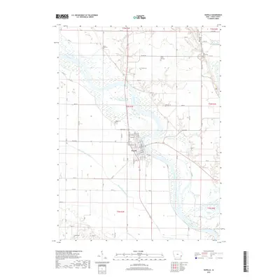
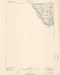
1946 Map of Wapello
USGS Topo · Published 1954About this map
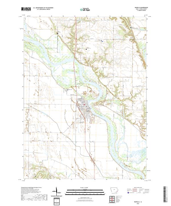
The confluence of the Mississippi River and the Iowa River dominates this mid-century survey, revealing a landscape defined by complex water management and river navigation. Near the town of New Boston, the river system fractures into a network of side channels and backwaters such as Sturgeon Bay, Mill Slough, and Boston Bay. The industrial and navigational importance of the waterway is anchored by Lock and Dam No 17 and a nearby Pumping Station, while the rural interior is dotted with local landmarks like Swan Lake Sch and Pin Oak Sch. This 1946 topography, compiled in part from 1938 aerial photography, provides a clear view of the numerous islands—including Mickey Island, Otter Island, and Jonas Johnson Island—that shift and change with the river's flow. Much of the western portion remains an Unsurveyed Area, contrasting the developed riverbanks with the less charted terrain beyond.
Find a feature on this map
38 named features on this map. Tap any name to fly to it.
Don’t see what you’re looking for? This feature index may not catch every label — zoom into the map to look around manually.
Map Details
Editions of this 1946 Wapello Map
2 editions found
Historical Maps of Wapello Through Time
8 maps found